Airports Maps: Simplify Your Flights
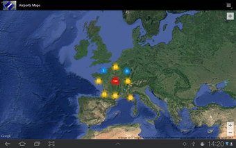
Airports Maps is a free Android application designed to simplify your flights. This navigation program requires VAC Atlas Viewer to be installed on your device to display data on the map. The application allows you to view the VAC Atlas Viewer's data on Google Maps and see the location of various types of airfields, including open to the public, restricted, mountain, and helicopter. The program is available in both French and English and has an ad-free interface.
Airports Maps has several features, such as viewing airfields on Google Maps, visualization of data with VAC Atlas Viewer, display filters, and more. This application is a must-have for pilots looking for a reliable navigation tool.